
Osh and the South: Sulaiman-Too, Arslanbob and the Alay Valley (2026)
A driving guide to southern Kyrgyzstan: Osh and its UNESCO-listed Sulaiman-Too, the Jayma Bazaar, the Karakhanid minaret at Uzgen, the walnut forests of Arslanbob, and the Alay valley with Lenin Peak on the horizon - plus the fly-to-Osh-and-rent-there play.
There are two Kyrgyzstans, and most travelers only ever meet one of them. The north is the country of Bishkek, Issyk-Kul and the alpine lakes - the one our earlier guides cover in detail. The south is something else: the hot rim of the Fergana Valley, a Silk Road city that locals will happily tell you is older than Rome, the largest natural walnut forest on Earth, and a high, wide valley where a wall of 7,000-metre mountains stands across the horizon like a painted backdrop. This guide is the missing southern chapter: what to see in Osh, the day trips to Uzgen and Arslanbob, the drive up into the Alay valley toward Lenin Peak, and the single smartest logistics move in Kyrgyz travel - flying south and picking up your car in Osh instead of driving two days to get there. Updated for September 2026.
First, the geography that explains everything. Osh sits about 670 km from Bishkek by road, and the drive between them - over two serious mountain passes - is a full, long day at the wheel, sometimes more. The flight takes under an hour and runs several times a day. That arithmetic is why we at WeRent keep cars in Osh as well as Bishkek: fly south, collect a car at the airport or in town, and spend your energy on the south itself rather than on the transit. Our 14-day itinerary builds the south in as its final act; this guide zooms in on the details.
Osh: the 3,000-year city
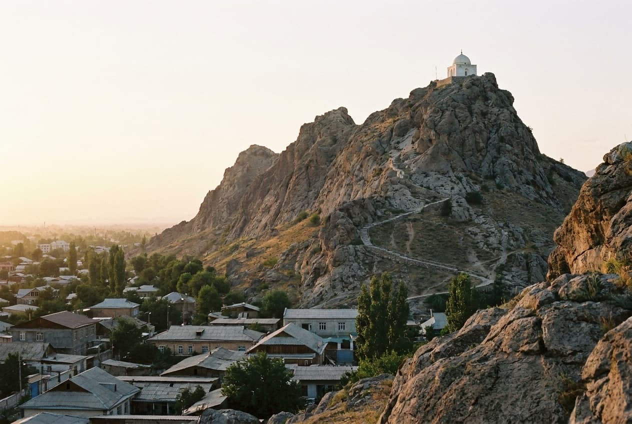
Kyrgyzstan's second city does not feel like a smaller Bishkek - it feels like a different country. Down here the air is warmer, the season longer, the plov heavier, and the streets carry a mix of Kyrgyz and Uzbek life that has flowed through the Fergana Valley for centuries. The city's axis is Sulaiman-Too, a five-peaked ridge of bare rock that rises straight out of the urban grid - Kyrgyzstan's first UNESCO World Heritage site and a pilgrimage mountain since long before anyone wrote its history down. The walk up is short, steep in places and absolutely worth doing in the soft hours of the day: a small mosque associated with Babur - the Fergana-born prince who went on to found the Mughal empire - stands near the summit, a museum sits inside a cave in the mountain's flank, and the view rolls green and hazy over the valley toward Uzbekistan. Entry to the mountain and museum costs a small cash fee.
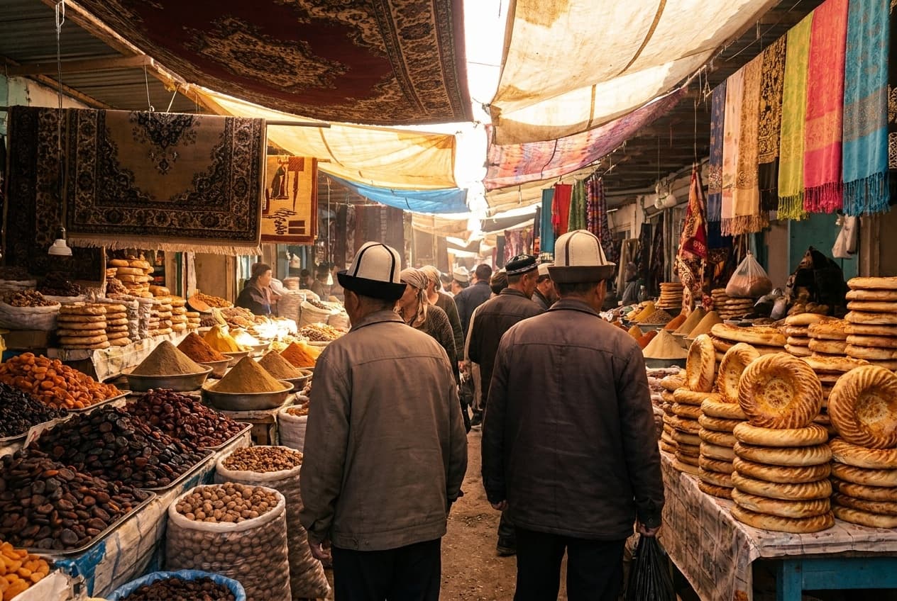
Back at street level, give a slow half-day to the Jayma Bazaar, one of the oldest working markets in Central Asia, strung for a long way along the Ak-Buura river. This is not a curated tourist bazaar - it is the city's kitchen and wardrobe: pyramids of dried apricots and walnuts, sacks of red Uzgen rice, bread stamped and blistered straight from the tandoor, knife-makers, cradle-sellers, and the best samsa you will find anywhere in the country. Come hungry, carry small notes, and let yourself get lost - the river always tells you where you are.
Uzgen: a red-brick minaret and the best rice in the country
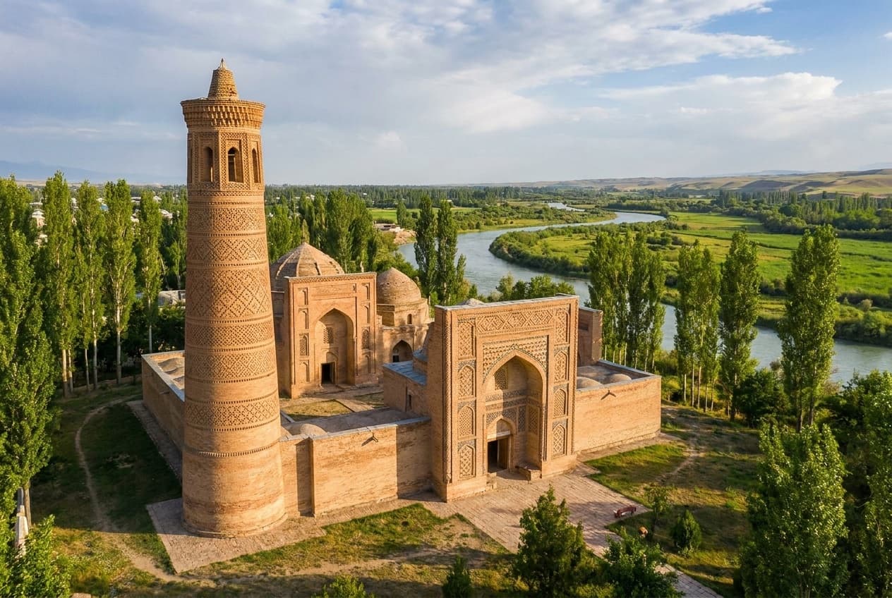
About an hour northeast of Osh on the main Bishkek road, Uzgen makes the easiest half-day trip in the south. A thousand years ago this was a capital of the Karakhanids, and what survives is small but genuinely moving: a squat, richly patterned red-brick minaret and a row of three mausoleums whose carved terracotta has been standing against Fergana weather since the 11th and 12th centuries. You can climb the minaret's tight spiral for a view over the rooftops and the river plain. The town's other claim to fame grows in the fields around it - the reddish Uzgen rice that southern cooks insist is the only correct base for plov. Buy a kilo at the local bazaar; it packs flat in a suitcase and beats any souvenir magnet.
Arslanbob: the world's largest walnut forest
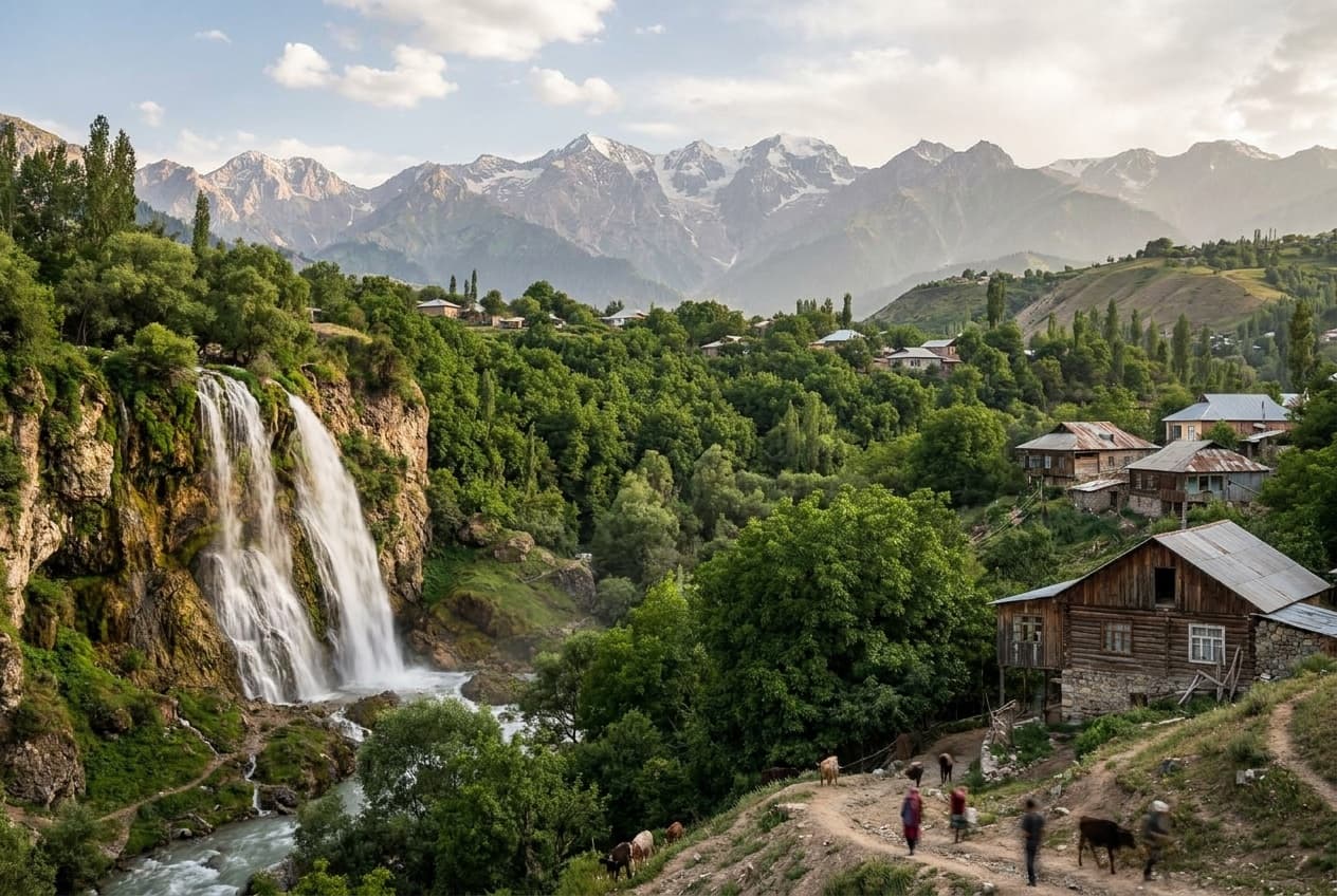
About three hours north of Osh, the road climbs out of the cotton-and-rice flatlands into something that should not exist: tens of thousands of hectares of wild walnut trees draped over mountain slopes, with the village of Arslanbob - Uzbek-speaking, apricot-drying, donkey-trafficked - tucked into the middle of it. Legend says Alexander the Great's soldiers carried walnuts home from these very slopes, which is why half of Europe calls them some variation of «Greek nuts». Come to walk under the canopy, ride to the waterfalls above the village, and sleep in a homestay arranged through the local CBT office - the community tourism network that has made Arslanbob its showpiece. If you can time it, come during the walnut harvest in early autumn, when whole families move into the forest and the village smells of woodsmoke and drying fruit. The asphalt gives way to rough patches near the top, but in dry season a careful driver manages in an ordinary car - our sedan-versus-SUV guide files this one under «comfort, not necessity».
The Alay valley: Lenin Peak across the horizon
South of Osh begins the most theatrical drive in southern Kyrgyzstan: the road that climbs out of the orchards, stacks itself into the famous switchbacks of the Taldyk pass at about 3 600 m, and drops you into the Alay valley - a treeless, wind-brushed corridor of grassland sitting around 3 000 m, walled on its far side by the Trans-Alay range. The centerpiece of that wall is Lenin Peak (7,134 m), one of the easier-to-see seven-thousanders on the planet: from the village of Sary-Tash, about three to four hours from Osh, the whole massif simply stands there across the valley, absurdly large, while sheep graze in the foreground. Push on toward the meadows and yurt camps around Tulpar-Kol lake below the peak's base camp and you get one of Central Asia's great overnight views for the price of a yurt bed. This is genuine high country: the season runs roughly June to September, the weather changes fast, and the last stretch to Tulpar-Kol is a rough track where an SUV earns its keep.
Sary-Tash is also a crossroads with a famous name: this is where the Pamir Highway turns south for Tajikistan, and standing at the junction you can feel the pull of it. Treat that pull with respect. Crossing an international border is a separate question from driving in Kyrgyzstan - paperwork, permissions and insurance all change at the line - so read our FAQ and talk to us before building any cross-border plan around a rental car. The good news: the Kyrgyz side alone, driven as an out-and-back from Osh, already delivers the Pamir Highway's most photographed Kyrgyz moments, no border stamp required.
A southern loop that works
The south rewards five or six unhurried days more than three rushed ones. Here is the shape we recommend to most travelers picking a car up in Osh:
- Day 1 - land in Osh, collect the car, climb Sulaiman-Too in the late afternoon light, dinner near the bazaar.
- Day 2 - a slow morning at Jayma Bazaar, then the half-day run to Uzgen's minaret and back.
- Days 3-4 - north to Arslanbob: walnut-forest walks, the waterfalls, a homestay night or two.
- Days 5-6 - south over the Taldyk pass to Sary-Tash and the Tulpar-Kol yurt camps, a night under Lenin Peak, and back to Osh.
Osh and the south: FAQ
How do I get from Bishkek to Osh?
Fly or drive. The flight takes under an hour and runs several times a day; the drive is about 670 km over two high mountain passes - a spectacular but full 10-12 hour day at the wheel. For trips of two weeks or less we recommend flying at least one way and renting a car in Osh itself.
How many days does the south deserve?
Five or six unhurried days cover the classics well: a day and a half for Osh itself, a half-day for Uzgen, two days for Arslanbob and two for the Alay valley. With less time, choose between the walnut forest and the Alay rather than rushing both.
Do I need a 4x4 for southern Kyrgyzstan?
Not for the core: Osh, Uzgen and the main road to Sary-Tash are paved, and Arslanbob is manageable in a careful sedan in dry season. An SUV earns its keep on the rough final track to the Tulpar-Kol yurt camps under Lenin Peak, and any time you travel outside high summer.
Can I drive the Pamir Highway into Tajikistan with a rental car?
Do not plan on it without talking to us first - taking a rental car across an international border involves separate paperwork, permissions and insurance, and the rules are covered in our FAQ. The Kyrgyz side alone, driven from Osh to Sary-Tash and the Alay valley and back, already delivers the highway's most famous Kyrgyz scenery without a border crossing.
When is the best time to visit Osh and the south?
The south runs warmer and longer than the north: Osh, Uzgen and Arslanbob are pleasant from spring well into autumn, and early autumn adds the walnut harvest. The high Alay valley is a summer story - roughly June to September - with cold nights at altitude even then.
Where do I sleep in Arslanbob and the Alay valley?
In Arslanbob, family homestays arranged through the local CBT office are the classic choice - simple, warm and generously fed. In the Alay, guesthouses cluster in Sary-Tash and yurt camps operate around Tulpar-Kol in summer. Book ahead in July, August and the harvest weeks.
The north gave Kyrgyzstan its postcards; the south gives it its depth - a mountain with three millennia of pilgrims, a bazaar that outlived every empire that taxed it, a forest that fed the Silk Road its walnuts, and a valley where a 7,000-metre wall closes the view. Best of all, the whole chapter starts one short flight and one car key away. Browse our fleet, set your pickup to Osh, and check the FAQ for the booking details - then go see the half of the country most travelers never meet. The plov is waiting, and it is not a light lunch.
Planning a trip to Kyrgyzstan? Pick your car and drive worry-free.
Browse the fleetSimilar posts

Karakol Travel Guide: Gorges, Hot Springs and Ski Season (2026)
Everything we know about Karakol, Kyrgyzstan's best mountain base: the Dungan mosque and wooden cathedral, ashlan-fu at the bazaar, the rough road to Altyn-Arashan's hot springs, Jety-Oguz's red cliffs, the Karakol valley - and the country's biggest ski area in winter.

Kel-Suu: Reaching Kyrgyzstan's Wildest Lake (2026)
How to reach Kel-Suu lake in 2026: the border-zone permit and how far ahead to arrange it, the 4x4 route through Naryn and At-Bashy, yurt camps in the Kok-Kiya valley, and the final approach by horse or on foot. An honest guide from the WeRent team.

Kyrgyzstan Itinerary by Car: 7, 10 and 14 Days (2026)
Three field-tested self-drive itineraries for Kyrgyzstan: a 7-day northern loop around Issyk-Kul and Karakol, a 10-day version that adds a yurt night at Song-Kul, and a 14-day plan that brings in Osh and the south - with honest daily driving hours, not optimistic ones.